-
 Get to know the dedicated professionals behind our success
 -

Biography
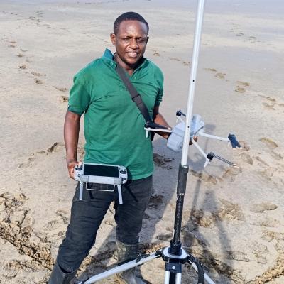
Kelvin Kamnde is an Assistant Lecturer in Marine Geomatics at the Institute of Marine Sciences (IMS), University of Dar es Salaam, Tanzania. He is a spatial analyst and Earth Observation specialist with extensive expertise in Geographic Information Systems (GIS), remote sensing, and geospatial data analytics applied to marine and coastal environments.
He holds a Master of Science in Geo-information Science and Earth Observation from the University of Twente (ITC), Netherlands, and a Bachelor (Hons) in Geography from the University of Dar es Salaam. He is currently pursuing a Ph.D. in Marine Sciences at the University of Dar es Salaam .
Kelvin has over a decade of professional experience in geospatial analysis, ecosystem mapping, and environmental monitoring. His work focuses on integrating satellite Earth Observation data, machine learning techniques, and spatial modelling to support sustainable management of marine and coastal resources. He has played key roles as a spatial analyst in multiple national and international projects, including initiatives under GMES & Africa (MarCOSIO), USAID SWAMP, DANIDA-funded programs, and the Western Indian Ocean Mangrove Network .
His research and technical contributions span mangrove ecosystem assessment, coastal resource mapping, floodplain and delta ecosystem analysis, biomass estimation using radar imagery, and climate-smart land use modelling. Notably, he has contributed to long-term mangrove monitoring (1989–2024), ecosystem change detection in the Lower Rufiji Floodplain and Delta, and the operational delivery of oceanographic information services to end users.
In addition to research, Kelvin is actively engaged in capacity building, having trained individuals, institutions, and organizations in GIS, remote sensing, and statistical analysis since 2013 . His work bridges science and application, supporting decision-making in coastal resilience, marine resource management, and environmental sustainability.
He has contributed to several peer-reviewed publications in areas such as environmental governance, forest management, and sustainability partnerships in Tanzania, demonstrating a strong interdisciplinary research profile.
Kelvin Kamnde is committed to advancing geospatial science in support of sustainable marine and coastal development, particularly within the Western Indian Ocean region.
Research Interest
Kelvin Kamnde’s research interests focus on the application of geospatial technologies, particularly Geographic Information Systems (GIS), remote sensing, and Earth Observation, to understand and manage marine and coastal ecosystems. He is particularly interested in ecosystem mapping, time-series analysis, and the use of machine learning to detect environmental change, assess ecosystem health, and model future scenarios in dynamic environments such as mangroves, coral reefs, and coastal floodplains.
His work also explores the integration of satellite-derived oceanographic data with in-situ observations to support operational oceanography and decision-making for sustainable resource management. He is interested in developing data-driven solutions for fisheries, climate resilience, habitat conservation, and coastal risk assessment, with a strong emphasis on translating scientific outputs into practical tools and services for policymakers, communities, and ocean users.
Contacts
Email:
Projects
Kelvin Kamnde has been actively involved in mangrove ecosystem assessment and sustainable management projects, including work under the Western Indian Ocean Mangrove Network and USAID SWAMP initiatives. His contributions focus on high-resolution mapping, temporal analysis of mangrove dynamics (1989–2024), and identifying suitable zones for sustainable utilization to support conservation and livelihoods.
He has played a central role in operational oceanography under GMES & Africa (MarCOSIO and MARCOSOUTH), where he derives oceanographic parameters from satellite data and translates them into actionable information for ocean users. This work supports fisheries, marine safety, and coastal resource management through near real-time geospatial services.
Kelvin is leading advanced ecosystem mapping and predictive modelling of the Lower Rufiji Floodplain and Delta, integrating multi-temporal satellite imagery, machine learning, and spatial analysis. His work identifies ecosystem changes, drivers of degradation, and future scenarios critical for resilience planning and sustainable development.
Kelvin Kamnde contributed as a spatial analyst under the DANIDA-funded NEPSUS project, where he applied advanced geospatial techniques to assess natural resource conditions across Tanzania. His work included national biomass mapping using ALOS-PALSAR radar data, coral reef and mangrove ecosystem mapping along the Mtwara coast, forest condition assessment in Kilwa District, and wildlife habitat analysis in Eastern Selous. He integrated multi-temporal satellite imagery, machine learning, and ecological modelling to generate decision-support information for sustainable resource management and conservation planning
His expertise extends to climate-smart land use and agricultural systems, where he has contributed to modelling the expansion of coffee farming and its environmental impacts under DANIDA-funded projects. This includes spatial modelling of land-use trade-offs and sustainability implications.
Publications
Gallemore, C., Kamnde, K. J., HENRIKSEN, L., & Brockington, D. (2022). The Environmental Impacts of Sustainability Partnerships in South-east Tanzania. Design and Methodology, 246.
Gallemore, C., Kamnde, K. J., Mwamfupe, A., Henriksen, L. F., & Brockington, D. (2022). The Livelihood Impacts of Sustainability Partnerships in South-east Tanzania. Design and Methodology, 270.
Henriksen, L. F., Gallemore, C., Kamnde, K., Silvano, P., Mwamfupe, A., & Olwig, M. (2023). Networks and institutions in sustainable forest use: Evidence from South-East Tanzania. Social Networks, 75, 39–54.
Henriksen, L. F., Kamnde, K., Silvano, P., Olwig, M. F., Mwamfupe, A., & Gallemore, C. (2023). Strong collaborative governance networks support effective Forest Stewardship Council-certified community-based forest management: Evidence from Southeast Tanzania. Global Environmental Change, 82, 102734.
Mabele, M. B., Kamnde, K., Bwagalilo, F., & Kalumanga, E. (2022). Calling for landscape-level assessments of participatory forestry’s role in improving forest biophysical conditions. Forest Policy and Economics, 143, 102816.
Noe, C., Brockington, D., John, R., Bwagalilo, F., & Kamnde, K. (2019a). Interrogating Wildlife Conservation Partnerships in Rufiji and Kilwa Districts, Tanzania: Context, Process and Sustainability Outcomes.
Noe, C., Brockington, D., John, R., Bwagalilo, F., & Kamnde, K. (2019b). NEPSUS Working Paper 2019/3.
Noe, C., Kweka, O., Minja, R. A., Katikiro, R., Silvano, P., Namkesa, F., Kamnde, K., John, R., Ponte, S., & Henriksen, L. F. (2022). Lessons from Research on new Partnerships for sustainability in Tanzania.
Ponte, S., Noe, C., Mwamfupe, A., Kweka, O., Kamnde, K., Olwig, M. F., Brockington, D., Henriksen, L. F., John, R., & Silvano, P. (2022). Design and Methodology. In Contested Sustainability: The Political Ecology of Conservation and Development in Tanzania (pp. 71–100). James Currey.